Vietnamese search and rescue teams were put back on alert today after a New Zealander working on an oil rig has now claimed he saw the plane disappear off the Vietnamese coast near Vung Tau.
Doan Huu Gia, deputy general director of Vietnam’s air traffic management confirmed authorities had received the email from Mike McKay, a New Zealander working on a rig operating in the Gulf of Thailand.
“He said he spotted a burning [object] at that location, some 300 km (200 miles) southeast of Vung Tau,” said the Vietnamese official.
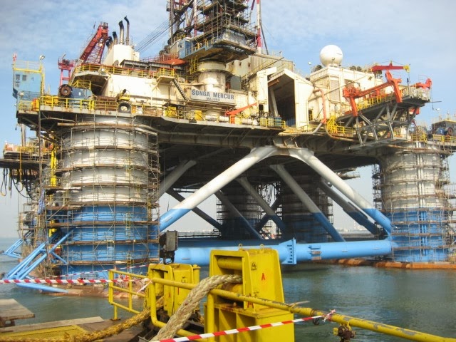
But McKay’s original email, sent the morning after the plane went missing, gave a more detailed different account. He said he was on the rig Songa Mercur when he saw the aircraft in flames.
Vietnamese officials later dismissed ‘McKay’s’ account. He could not be contacted to verify any information and the Vietnamese later announced they were not treating the information seriously.
However ABC’s Bob Woodruff confirmed he spoke to Idemitsu Oil & Gas Co, the company currently hiring the rig, who confirmed the report is genuine.
So many different reported radar or visual sightings have been made of flight MH730 now – and the latest report is the a blip was detected by Malaysian radar north west of Penang – that relatives of those on the missing flight have lost their patience. Much of the anger has been directed at Malaysian Airlines officials.
(Link: Cutting through the bullshit about MH370. Do not agree with all of this but…)
McKay’s message timed at 6.24 today goes as follows:
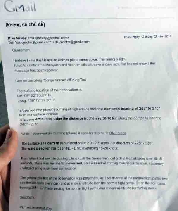
‘Gentlemen. I believe I saw the Malaysian Airlines flight come down. The timing is right.
“I tried to contact Malaysian and Vietnamese officials days ago. But I do not know if the message has been received.
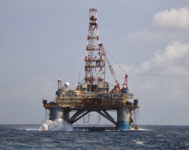
“I am on the oil ring Songa-Mercur off the coast of Vung Tau.
‘The surface location of the observation is Lat 08 22’ 30.20” N
Lat 108 42.22.26” E
“I observed (the plane?) burning at high altitude at a compass bearing of 265* to 275*
 |
| Vung Tau is down river on the coast from Ho Chi Minh City |
‘It is very difficult to judge the distance but I would say 50 to 70 kms along the compass bearing 260-277.
“While I observed (the plane) it appeared to be in one piece.
“The sea surface current at our location is 2-2.3 knots in the direction of 225-230.
“The wind direction has been E-ENE averaging 15-20 knots.
“From when I first saw the burning (plane?) until the flames went out (at high altitude) was 10-15 seconds.
“There was no lateral movement so it was either coming toward our position stationary (falling) or going away.
“The general position of the observation was perpendicular/ south west of the normal flight paths.
(We see the con trails every day) and at a lower altitude than the normal flight paths or on the compass bearing 265 to 275 intersecting the normal flight paths at normal altitude but further away.
“Good Luck”
Michael Jerome McKay


Of all the wild theories being discussed and investigated, this is the only theory that rings true to me. If the lithium batteries in the cargo hold started a fire, then it is quite plausible that Mike's observation of a burning object was the plane going down exactly where it would be expected to be. Not in the Indian Ocean but right there in the South China Sea.
To enter directly into google maps, copy & paste this.
8.375064, 108.706183
They picked up on it a bit late that's all. Many Running with it today.
If this is credible why is the mainstream media ignoring it?
Lat 08 22’ 30.20” N Lat 108 42.22.26” E
Is the rig being towed? Because I don't think there is any drilling at that coordinate. The Mercur was at the CA NGU-1 well south of Danang in late December 2013.
Simple: he saw something – apparently a flame or fire – then reading the headlines stating the missing plane – he made what I'd call a quite obvious assumption. If it is indeed what he saw.
In any case it is quite horrendous if the officials receiving the message of his observation didn't take it seriously.
I would like to google earth with the Longitude and latitude. If someone could supply them. Where is the Oil rig?
Given the time was apparently 0130 hrs it is difficult to imagine how the observer might have concluded the burning object was an aircraft. Depending upon the angle of trajectory to his position, it may well have been a meteorite………
Seems to me a good information and I hope this information is the key to find the airplane. I cruised the South China Sea last year two times with Aida Cruiseliner and all mentioned details fit into my picture about the flight of MH370.